 GPXdrone
Free Online GPX Viewer
Upload a GPX file from your hike, ride or run and see it rendered in 3D on real satellite imagery and terrain — right in your browser, free, with no install and no account.
Upload your GPX file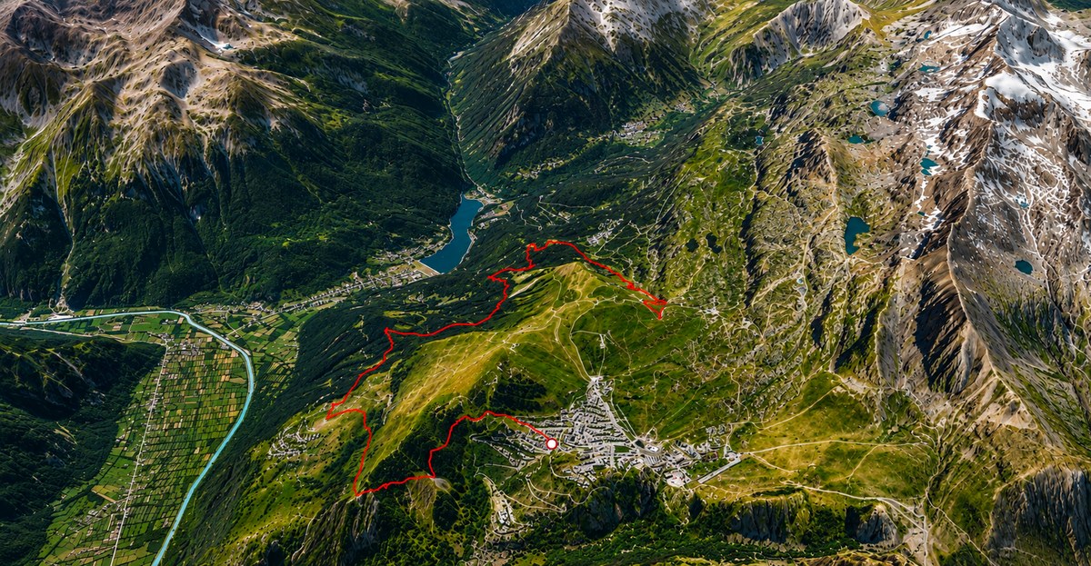
A GPX viewer built for real terrain, not just a flat map
Most GPX viewers drop your track on a flat 2D map with a list of waypoints and a distance/elevation chart next to it — useful, but it doesn't really show you the ground your route actually crosses. GPXdrone is a 3D GPX viewer: it loads real world terrain and satellite imagery under your track (powered by Cesium ion) and replays the route as a smooth, continuous flight over the actual landscape, ridgelines and valleys included.
What is a GPX file?
A GPX file (GPS Exchange Format) is a small, open XML file that stores a sequence of GPS
points — latitude, longitude, elevation and often a timestamp — recorded by a GPS watch,
phone app or bike computer, or exported from a platform like Strava, Komoot, Garmin
Connect or Suunto. It's the standard format for saving and sharing a route: a hiking
trail, a bike ride, a run, or a flight path. On its own, a GPX file is just data — it
doesn't show you anything until you open it in a GPX viewer. That's what
GPXdrone does: drop your .gpx file in and it renders the actual route in 3D,
ready to explore or export as a video.
How the GPX viewer works
- Export a GPX file from Strava, Komoot, Garmin, Suunto or any GPS device/app.
- Drag it into GPXdrone, or use the upload button above.
- The track is parsed entirely in your browser — nothing is uploaded just to view it.
- Watch your route replay as a 3D flyover, with an elevation profile you can scrub.
Who it's for
Hikers, cyclists, trail runners — anyone who wants to actually see a route before or after doing it, rather than just read numbers off a stats page. It works for any GPX track, whatever device or app it came from.
Free, and no data leaves your device to view a track
Viewing a track is entirely client-side: your GPX file is parsed in the browser and never sent to any server. GPXdrone only talks to a server at all if you choose to export a video on a browser that can't encode video locally — see GPX to Video for details.
Frequently asked questions
What is a GPX viewer?
A GPX viewer is a tool that reads a .gpx file and displays the route it
contains — usually on a map, and in 3D in GPXdrone's case — rather than the raw list of
GPS coordinates the file itself is made of.
Can I view a GPX file online?
Yes — GPXdrone runs entirely in your browser at gpxdrone.com. Drop in a .gpx file and it renders immediately, with no install and no account required.
Which apps can export GPX files?
Most GPS and fitness apps can export a route as GPX, including Strava, Komoot, Garmin Connect, the Suunto app, and most standalone GPS devices and watches.
Does GPXdrone upload my GPX file?
No — for viewing, your GPX file is parsed entirely in your browser and never sent to a server. Only exporting a video on a browser without local video encoding support uploads captured frames — see GPX to Video for details.
Explore GPXdrone