 GPXdrone
3D GPX Viewer
A flat map only tells you where a route goes. GPXdrone shows you what it actually looks like — real elevation, real satellite imagery, and a camera that flies the route with you.
Upload your GPX file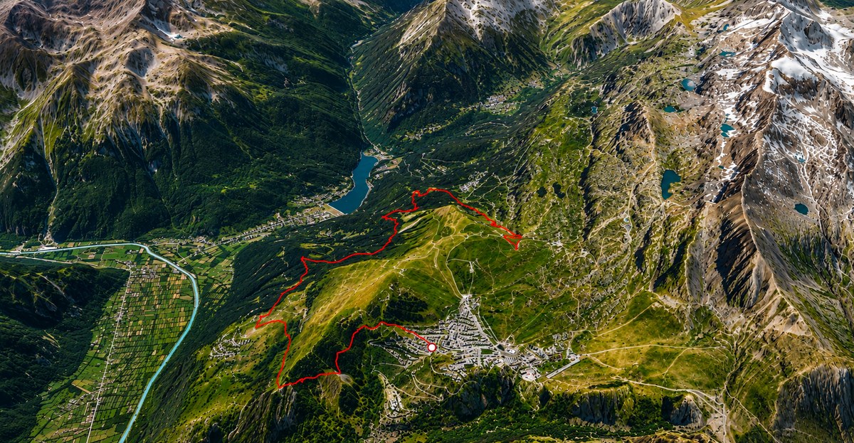
Real terrain, not a flat texture
GPXdrone loads actual world terrain elevation data and real satellite imagery (via Cesium ion) under every track — mountains, valleys, ridgelines and cliffs all render at their true shape, not a flattened 2D projection. Your GPX line is sampled against this real terrain and drawn a few meters above it, so it visibly follows the ground instead of floating over a generic backdrop.
A camera that follows the route like a drone
Instead of a static top-down view, GPXdrone's chase camera trails your route at an adjustable distance, banking gently through turns and tilting to keep the path in view — closer to how an actual drone would follow a hiker or a cyclist than a fixed map view.
Explore elevation and terrain in 3D
A mountain route is hard to read on a flat map — a switchback climb, a ridge walk or a descent into a valley all end up as the same flat line, with elevation reduced to a small chart off to the side. In 3D, the terrain itself does the explaining: you can see how steep a climb really is, how a route threads between two peaks, or how a valley shapes the path a river or a trail takes. GPXdrone renders your GPX track directly on top of real elevation data, so the mountain, the ridge or the col is right there in the scene, not a number you have to interpret separately.
This matters most for exactly the routes a flat GPX viewer struggles with: alpine hikes, mountain bike descents, trail runs with serious elevation gain. Seeing the actual terrain makes the route make sense at a glance.
Three lighting presets
Day, foggy or evening light — pick the mood that fits your route before replaying or exporting it.
Works with any GPX track
Hiking, trail running, cycling, or a drone flight log — if it's a valid GPX file (Strava, Komoot, Garmin, Suunto, or any GPS device), GPXdrone's 3D viewer can replay it. Once you've seen your route in 3D, you can also export it as a video.
Explore GPXdrone